When Dolphin Scars Become Data: Citizen Photos Driving Smarter Coastal Development
In Galveston Bay, dolphin fins have become unlikely guides for smarter coastal decision-making, turning thousands of citizen-shot photos into hard evidence that reshapes how we boat, fish, and build along the shore. By pairing a rigorous injury-classification rubric with community-powered monitoring, researchers have created a living dataset that reveals where, when, and how human activities leave their mark on marine mammals. Those same insights now inform vessel speed limits, gear choices, public education campaigns, and even long-term urban planning, offering a compelling blueprint for any coastal community looking to align growth with genuine environmental stewardship.
Building Data-Driven Conservation Strategies
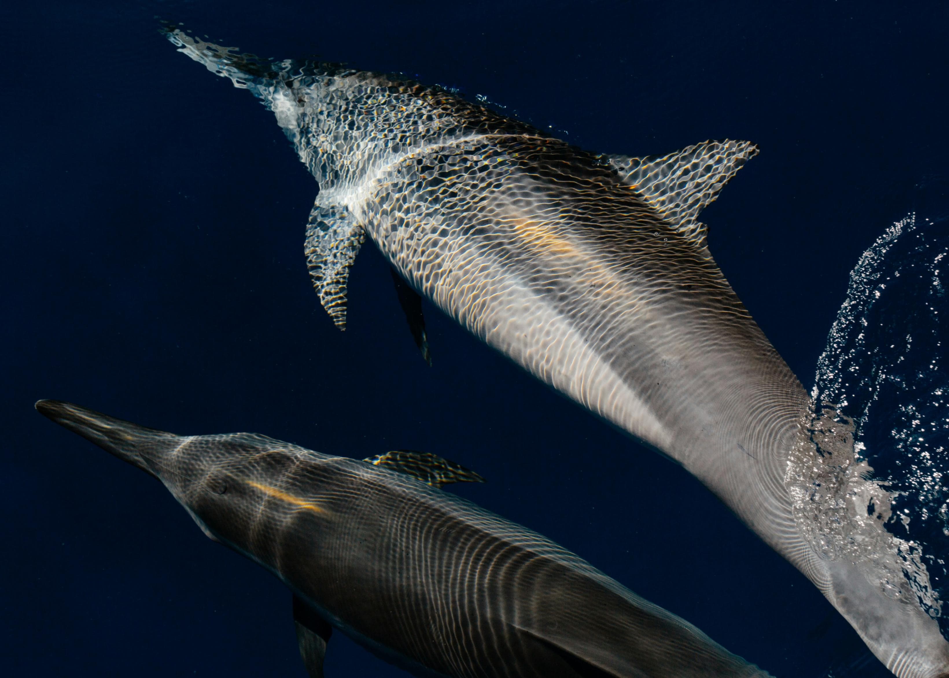
The injury-classification rubric developed during the Galveston Bay Dolphin Research Program served as a foundational tool for linking specific injury types to human activities, particularly fisheries-related interactions. This standardized framework not only enhanced internal data consistency but also allowed for comparative analysis with similar studies in other estuarine systems. Applying the rubric to over 3,000 images required meticulous cross-checking and validation, which was achieved through a multi-stage quality control process. This ensured the reliability of injury identification and supported data integrity over time.
Creating a robust dataset on dolphin injuries has direct implications for conservation policy. By identifying spatial and temporal trends in fishery-related injuries, the team was able to inform recommendations for vessel speed regulations, gear modifications, and public awareness campaigns. These insights are critical for agencies like NOAA and regional marine protection organizations that depend on high-quality data to guide enforcement and outreach strategies. A strong evidence base also supports grant applications and funding requests for further research and mitigation efforts, making rigorous data collection and classification essential to effective conservation work.
Engaging the Public in Environmental Stewardship
A key feature of the program was its integration of citizen scientists in data collection. Volunteers contributed land-based photos throughout the year, expanding the spatial and temporal coverage of the study without significantly increasing costs. Training materials and workshops were created to guide volunteers in image submission protocols, ensuring the consistency and usability of the data. This element of public engagement not only enhanced research capacity but also helped build a community of informed environmental advocates.
Translating scientific findings into accessible outreach materials proved instrumental in expanding the program's public impact. Presentations, educational events, and social media content were tailored to different audiences, from school groups to local policymakers. By linking visual evidence of dolphin injuries to common boating and fishing practices, the team fostered a sense of shared responsibility among stakeholders. Research shows that when community members understand the tangible impacts of their actions on local ecosystems, they are more likely to support and participate in conservation initiatives (Jacobson et al. 2015)1.
Leveraging Cross-Sector Collaboration for Environmental Goals
Effective conservation often requires partnerships that span government, academia, and nonprofit organizations. During the Galveston Bay initiative, collaboration with local marine biologists, state wildlife agencies, and environmental nonprofits enabled the research team to align their work with broader regional goals. These partnerships helped ensure that the injury-classification rubric and resulting data were compatible with existing wildlife monitoring protocols and could be integrated into long-term management plans.
Local governments benefit from such coordination when designing environmental ordinances or planning coastal development projects. For example, data from this kind of research can inform the placement of speed-restriction zones or the timing of dredging activities to minimize impacts on marine mammals. Governments that integrate scientific research into permitting and policy decisions are better equipped to balance economic development with environmental preservation, a principle supported by multiple case studies in coastal management (Beatley, Brower, and Schwab 2002)2.
Practical Applications for Local Environmental Policy
The research conducted in Galveston Bay illustrates how localized ecological data can inform practical policy solutions. For local governments, implementing targeted boating regulations, promoting sustainable fishing practices, and investing in public education campaigns are all viable steps that can stem directly from this type of research. By using photographic evidence and injury frequency data, policymakers can make a stronger case for specific interventions, such as seasonal boating restrictions or mandatory use of wildlife-safe fishing gear.
Municipal planners should consider building relationships with academic and nonprofit researchers who can supply ongoing environmental assessments. This helps ensure that environmental policies are grounded in current ecological conditions and can adapt in response to emerging threats. Programs that track injury trends over time also allow for the evaluation of policy effectiveness, enabling a feedback loop that supports continuous improvement. As climate change and urban development place increasing pressure on coastal ecosystems, data-driven, adaptive management becomes a necessity rather than a luxury (National Research Council 2004)3.
Integrating Conservation into Broader Urban Planning
Conservation efforts focused on marine mammals should not exist in isolation from broader urban planning considerations. In coastal regions like Galveston, infrastructure projects such as port expansions, shoreline armoring, and stormwater management all have indirect effects on local wildlife. Integrating wildlife data into environmental impact assessments can help identify and mitigate potential harms before construction begins. For example, known dolphin hotspots identified through photo tracking can be designated as high-sensitivity zones in regional planning documents.
Planners and administrators should treat environmental data as a core input in infrastructure siting and design. Using GIS layers that include wildlife movement patterns, injury hotspots, and water quality metrics allows for holistic decision-making. In jurisdictions with strong interdepartmental coordination, environmental data can be shared across planning, public works, and emergency management teams to enhance resilience efforts. This approach aligns with best practices identified by the U.S. Environmental Protection Agency, which recommends incorporating ecosystem services into local planning frameworks (EPA 2016)4.
Long-Term Impact and Capacity Building
One of the lasting impacts of the Galveston Bay Dolphin Research Program has been its contribution to local capacity building. By training volunteers, students, and early-career professionals in standardized data collection and analysis methods, the program has helped cultivate a knowledgeable workforce that can support future environmental initiatives. These individuals often go on to serve in local agencies, nonprofits, or research institutions, carrying forward the skills and values developed during their participation.
For governments seeking to build long-term environmental capacity, investing in community science and internship programs offers a high return. Not only does it expand the reach of current projects, but it also fosters public ownership of local conservation goals. Programs like this also support environmental literacy by making complex ecological processes understandable and relevant to everyday life. The stronger the connection between communities and their natural environments, the more resilient both become in the face of ecological and economic challenges (Berkes 2009)5.
Bibliography
Jacobson, Susan K., Mallory D. McDuff, and Martha C. Monroe. Conservation Education and Outreach Techniques. Oxford: Oxford University Press, 2015.
Beatley, Timothy, David Brower, and Anna K. Schwab. An Introduction to Coastal Zone Management. Washington, DC: Island Press, 2002.
National Research Council. Adaptive Management for Water Resources Project Planning. Washington, DC: National Academies Press, 2004.
U.S. Environmental Protection Agency. Smart Growth and Ecosystem Services. Washington, DC: EPA, 2016. https://www.epa.gov/smartgrowth/smart-growth-and-ecosystem-services
Berkes, Fikret. Evolution of Co-management: Role of Knowledge Generation, Bridging Organizations and Social Learning. Journal of Environmental Management 90, no. 5 (2009): 1692-1702.
More from Conservation and the Environment
Explore related articles on similar topics