How AI Image Recognition Pinpointed Lunar Cave Entrances
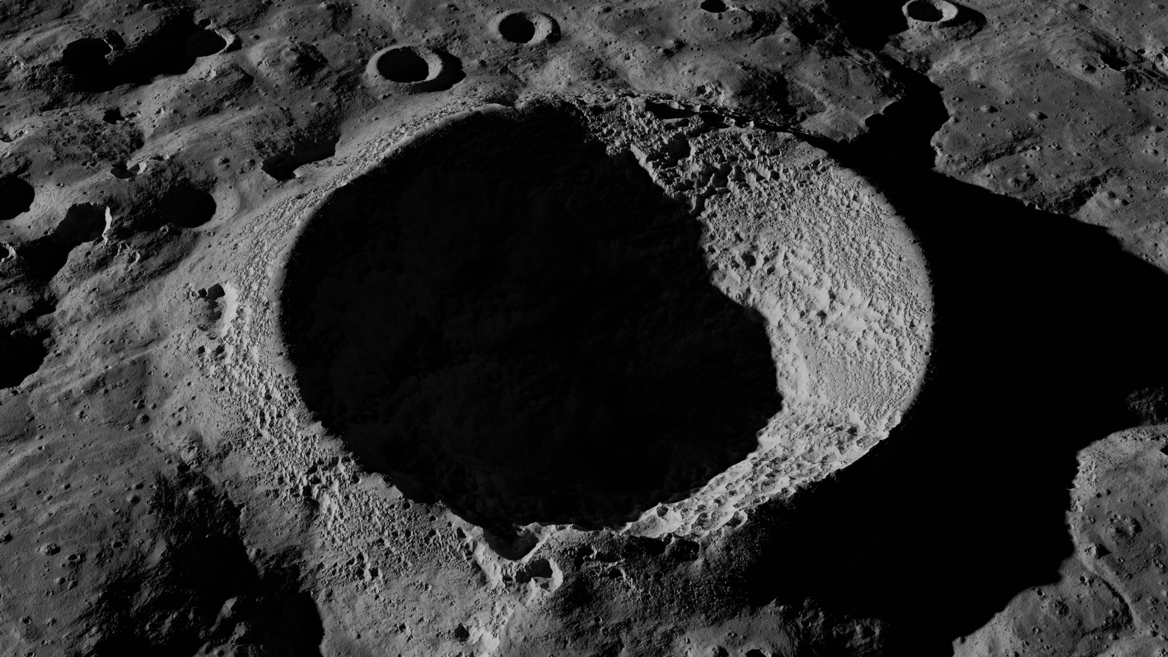
The identification of new lunar cave entrances was made possible through the advanced deployment of artificial intelligence-powered image recognition systems. These systems, trained on vast datasets of lunar surface imagery, analyzed thousands of high-resolution images captured by NASA's Lunar Reconnaissance Orbiter (LRO). By applying convolutional neural networks (CNNs), researchers were able to detect subtle variations in pixel patterns that human analysts might overlook. These anomalies often signify collapsed skylights or sinkhole-like features that indicate potential cave entrances or lava tubes beneath the surface. One recent study led by researchers at the SETI Institute used machine learning models to expand the Lunar Pits Atlas, adding new potential access points to subterranean lunar environments with a high degree of confidence based on image pattern consistency, light shadow analysis, and geological context¹.
These discoveries are not isolated events but represent a broader shift in planetary analysis. Traditional manual interpretation of orbital imagery is time-consuming and prone to subjective bias. AI systems, by contrast, can rapidly scan and evaluate surface features across entire hemispheres of the Moon, identifying patterns at scale. This capability is especially critical in identifying caves, which offer strategic value for future missions. The use of AI for lunar surface mapping not only enhances precision but also ensures that each new feature is cataloged with standardized metadata, making it easier for space agencies and private partners to incorporate into mission planning frameworks².
Lunar Caves as Strategic Habitats for Human Missions
The newly identified lunar caves offer more than scientific intrigue. These structures could serve as pre-built shelters for astronauts, mitigating several of the Moon's most inhospitable conditions. The lunar surface is bombarded by cosmic radiation and solar flares, experiences temperature swings from -173°C at night to 127°C during the day, and lacks any atmospheric protection from micrometeorites. Natural caves, suspected to be remnants of ancient lava tubes, offer enclosed environments that can shield equipment and personnel from these hazards. The thermal inertia of subterranean rock also provides a more stable internal temperature, reducing power demands for climate regulation³.
These potential habitats align with the Artemis program's objective to establish a sustainable human presence on the Moon. NASA has already assessed the structural integrity of some identified pits using shadow analysis, and ongoing robotic missions may further evaluate their depth and accessibility. Once confirmed, these caves could be equipped with inflatable modules, power storage systems, and airlocks, creating a hybrid natural-artificial base that is less resource-intensive than constructing shelters on open ground. For Mars missions, where transport costs are even higher, learning to utilize existing geological formations as shelters could set a precedent for habitat design⁴.
The Lunar Pits Atlas as a Planning Resource
The Lunar Pits Atlas, a growing geospatial repository of lunar cave features, is becoming a critical resource for mission architects at NASA, the European Space Agency (ESA), and commercial partners. Updated with AI-analyzed imagery, the atlas provides detailed coordinates, pit dimensions, estimated depths, and local terrain context for each identified feature. This data allows mission planners to prioritize landing zones near promising cave sites and assess the feasibility of robotic or human exploration. The inclusion of topographical overlays and solar illumination models also enables more sophisticated energy planning for solar-powered equipment⁵.
For instance, a mission targeting a pit near the Moon’s equatorial region can use the atlas to determine how much sunlight the surrounding area receives, informing battery and solar panel requirements. Similarly, ESA's Moon Village concept has referenced data from the Lunar Pits Atlas to identify potential modular base locations. The private sector, including firms like ispace and Astrobotic, also utilizes this information to align their lander deployments with strategic geological features. The atlas facilitates shared understanding across agencies, reducing redundancy and promoting collaborative exploration strategies⁶.
Expanding AI’s Role in Extraterrestrial Exploration
Beyond cave detection, AI is revolutionizing how space agencies approach geological modeling and autonomous exploration. Machine learning algorithms are being used to simulate subsurface structures, predict resource deposits, and guide robotic navigation. For example, NASA’s VIPER mission, set to explore the Moon’s south pole, incorporates AI-driven terrain analysis to optimize rover pathfinding and avoid hazardous zones. These capabilities are essential in environments where real-time human control is limited by communication delays⁷.
On Mars, AI systems have already proven their effectiveness through the Perseverance rover’s ability to autonomously identify rock samples of high scientific value. Similar methodologies can be applied to lunar missions, where quick decision-making on sample collection or route adjustments can enhance mission efficiency. Municipal governments and public administration students can draw parallels to urban infrastructure monitoring, where AI can analyze satellite data for sinkholes, structural shifts, or flood risks. The same logic applies: detection at scale, informed by machine learning, allows for better resource allocation and strategic planning.
Finding Shelter with Machines: A New Chapter in Exploration
The discovery of lunar caves through AI is a pivotal development in humanity’s quest to inhabit other worlds. These natural structures, identified through machine analysis, are not just geological formations but potential sanctuaries that can support life beyond Earth. They offer a low-energy, high-benefit solution to some of the most formidable challenges in space habitation. From shielding astronauts to conserving construction resources, their utility could redefine how we approach extraterrestrial colonization.
Artificial intelligence is helping us locate safe havens in the most hostile environments imaginable. What began as a tool for data analysis has evolved into a strategic asset for space infrastructure planning. As municipalities begin to explore smart city applications and resilience strategies, the methods used to find shelter 238,000 miles away can offer a surprising model. When machines lead the way, the paths we uncover may take us deeper into both outer space and a more intelligently designed future here at home.
Bibliography
Wagner, Ryan V., Mark S. Robinson, and Tyler J. Giguere. “Lunar Pits: Sublunarean Voids and the Prospects for Human Habitation.” Planetary and Space Science 122 (2016): 1–11.
Hughes, Steven. “AI and the Mapping of Lunar Terrain.” NASA Goddard Space Flight Center, 2023. https://www.nasa.gov/goddard/ai-lunar-mapping.
Horvath, David, et al. “Thermal Stability of Lunar Lava Tubes.” Geophysical Research Letters 48, no. 8 (2021): e2020GL091372.
NASA Artemis Program Office. “Artemis Base Camp Concept: Lunar Infrastructure Requirements.” NASA Technical Paper, 2020. https://www.nasa.gov/specials/artemis-base-camp/.
Haruyama, Junichi, et al. “Possible Lunar Lava Tube Skylight Observed by SELENE Cameras.” Geophysical Research Letters 36, no. 21 (2009): L21206.
European Space Agency (ESA). “Moon Village - ESA’s Collaborative Approach to Lunar Exploration.” ESA White Paper, 2021. https://www.esa.int/moonvillage.
NASA Ames Research Center. “VIPER: Volatiles Investigating Polar Exploration Rover.” Accessed March 2024. https://www.nasa.gov/viper.






Join the discussion
Members can read and add comments on every article.